Part of our complete guide: Madeira’s hiking trails: the PR routes explained
- Length
- 4.3 km
- There and back
- 8.6 km
- Walking time
- 3:00 h
- Difficulty
- moderate
- Altitude
- 964–1,288 m
- Start
- Rabaçal (E.R. 105)
- End
- 25 Fontes
- Fee
- €4.50 per person (as of 2026-08), booked via SIMplifica
PR 6 — The route
Open this route interactively on OpenStreetMap
What it is like
From the car park on the ER 105 you first drop about 250 m down a surfaced access road into the valley — comfortable on the way in, and exactly the same climb at the end of the day when your legs are already done. A shuttle bus runs this section from the car park if you want it.
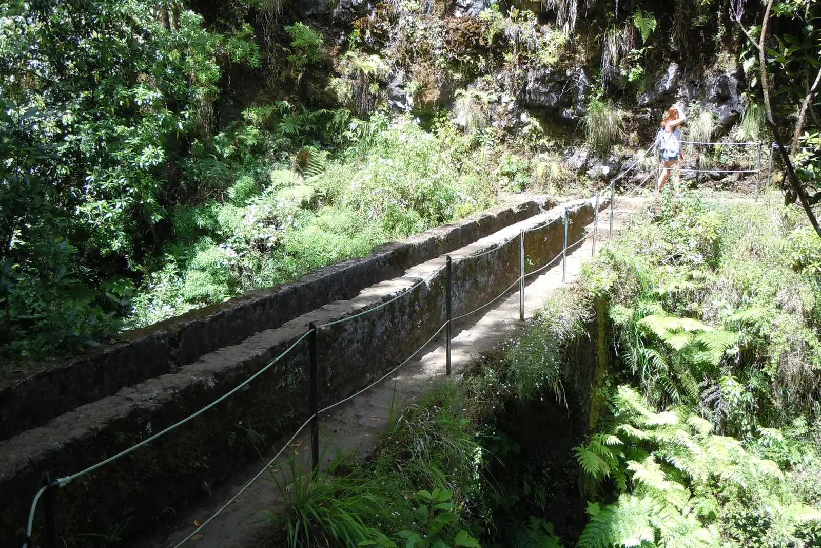
At the bottom the levada proper begins: level, narrow, channel on one side, hillside on the other. In places the ledge is under a metre wide with no railing. It is wet at all times.
PR 6 — Elevation profile
The 25 Fontes basin itself sits on a short spur — the dashed line on the map above. On a good water day a dozen falls and more come out of the wall at once; the name exaggerates, but not by much.
What is hard here, and what is not
In fitness terms PR 6 is harmless: a levada does not climb, that is how it is built. The 250 m on the access road is all of it.
The difficulty is elsewhere. The ledges are narrow, the rock is polished, and at several points the ground falls away steeply beside you. If you are not comfortable with exposure you will find this harder than the summit path to Pico Ruivo — even though the two carry the same grade.
Boots with a proper sole are not optional. Trainers on wet levada stone are the single commonest cause of rescue call-outs on this island.
Combining it with PR 6.1
PR 6.1 to the Cascata do Risco branches off from the same starting point: 1.5 km to a single tall waterfall. The two share their first stretch, and most people add the Risco loop — it costs about an hour extra.
Two routes mean two reservations, though. That gets missed regularly.
Getting there
The car park is on the ER 105 between Paul da Serra and Rabaçal, at about 1,290 m. It is small and full from mid-morning on fine days, and the plateau above is often in cloud while the coast is in sun.
Without your own car this one is difficult — there is no bus service up here. Hiking transfers run it regularly.
Booking
Fee and reservation required through SIMplifica, in 30-minute slots. The process is under booking trails.
Common questions
How far is it really? Officially 4.3 km — one way. There and back is 8.6, and the three hours allowed are tight if you stop at the waterfall.
Is the shuttle worth it? For the return, almost always. The climb back up the access road at the end of a long day is the least popular part of the whole walk.
Can you swim in the basin? It is not permitted, and the water is around ten degrees.
Guided or on your own? The route is impossible to lose. A guided levada tour (Affiliate link) takes the drive and the booking off your hands — more under levada tours.